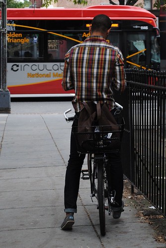
‘He matches the bus!!!’
courtesy of ‘fromcaliw/love’
We’ve come a long way from the days of highlighting a route on a paper map to get from Point A to Point B. And in a big city like Washington, there are so many ways to get around: walking, biking (your own or a shared bike), taking transit, driving, Segway-ing, etc. But with so many options, it’s often difficult to figure out what the shortest/fastest/easiest way to get somewhere is. Lucky for us, there are lots of great tools out there that make it a whole lot easier to get around the city. Here are our picks for our favorite tools for getting around the District!
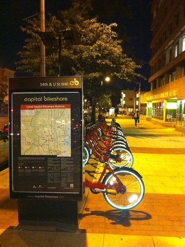
‘Capital Bikeshare at Night’
courtesy of ‘tedeytan’
5. Capital Bikeshare (Online Map and Apps)
Since joining Capital Bikeshare a few months ago, I’ve been surprised at how frequently I use it. It’s great for taking short trips to Metro or running quick errands, and the best part is that you don’t have to pre-plan your trip. Just check out their constantly-updated Station Map, which shows you which stations have bikes or open docks available. Being a bikeshare member makes getting around the city so much easier, because you can add in a bike ride to any part of your trip. Going from Columbia Heights to Dupont Circle? You can bike the whole way there, or bike over to Adams Morgan and take the L2, or bike over to Mount Pleasant and catch the 42– your call. And when you’re out, you can bring up the app on your phone (there are a couple good free apps to choose from: SpotCycle, iFindBikes, or Bixou), figure out what bikeshare station is closest to you, and see how many bikes are available there. It makes it so easy to decide on the fly whether you’ll be biking part of the way to your next destination.

‘read the sign!’
courtesy of ‘philliefan99’
4. Google Maps
Getting directions from Google couldn’t be simpler– just tell it where you are and where you’re going, and which mode you’d like to take (driving, transit, walking, or biking), and Google Maps will show you the way. It will also give you different options and tell you generally how long it will take. There’s just one catch: here in DC, Metro hasn’t yet gotten on board with sharing its data with Google, so the transit directions are currently pretty useless. However, it looks like they’ll start working together any day now, so keep your fingers crossed! Even without the transit data though, Google is a great way to figure out driving, walking, or biking directions in the city.

‘R0010349’
courtesy of ‘digital_don’
3. HopStop
HopStop is a great tool for getting from Point A to Point B in the city. It’s just like the Metro trip planner, but it gives you excellent walking directions and waiting times too. Tell it where you’re going, and what modes you’re interested in taking (walking, Metro, bus, or a combination), and it’ll tell you exactly long it will take you. It gives you fantastic door-to-door directions, complete with 360 degree street views to get a feel for an area. It’s the best tool for telling you how long it’ll take to walk somewhere, how long you’ll be waiting for the bus or train, how long that bus/train trip will take you, and how long it will take to get to your destination. Great tool for down-to-the-minute trip planning.
‘Doomed.’
courtesy of ‘Cazimiro’
2. Metro Trip Planner, Metro Apps, and NextBus Apps
Metro’s Trip Planner is really helpful in figuring out the best transit options between two points in the region. You can tell it whether you want to travel by bus, rail, or both, and you can tell it whether you want the fastest route, the easiest route, or the least-walking route. It’s usually my go-to tool for figuring out how to get to a new address in the city.
And NextBus has pretty much changed my life. All that standing outside at a freezing cold bus stop, waiting for the bus to arrive? Just a distant memory. I check my NextBus app before leaving the house, so I can minimize how much time I spend waiting out in the cold. The apps for Metro waiting times (like iMetroMap, which shows you exactly what the electronic displays on the platform say) are also great– you can always know whether there’s enough time to grab another drink at happy hour or whether you need to say your goodbyes and catch that next red line train.

’15th St bike lane in use’
courtesy of ‘nevermindtheend’
1. Ride the City
Ride the City is, hands down, the best tool to get around the city by bike. Tell it where you are and where you’re going, and it will give you three different options for biking there: the safest route (going out of your way to use side streets and bicycle lanes), the safe route (using bike facilities but not going too far out of your way), and the most direct route. It also tells you how far of a trip it is, about how long it will take you, and how many feet of elevation gain you’ll experience. Their map also shows you bike shops and bike share station locations. It’s just a fabulous tool that makes biking around the city a lot less intimidating.
Pingback: Tweets that mention Five Favorites: Tools for Getting Around DC » We Love DC -- Topsy.com
Great suggestions, all, and I am *mostly* a fan of NextBus, but it only works if the bus driver turns on the gps on the bus. More than a few times I have been told there is no bus coming when there is one around the corner. One time I spoke to Metro CS, and the CS agent told me taht if the gps system isn’t connected, then the NextBus system will think there is no bus at all…
I like the mobile version of the Circulator site http://circulator.dc.gov/ It’s great on the iPhone.