‘F Street – SW, SE, and NE – 04-9-10’
courtesy of ‘mosley.brian’
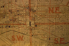
While this map here isn’t from DCRA’s collection, the District’s regulatory agency, which includes mapping, permitting and surveying groups, will be releasing all of their collected maps and plats via their Flickr account later today and in the coming weeks. I can only imagine the treasure trove that is their map room, full of images of the city throughout its 200 year plus history. As a committed map nerd, I’m also hoping that they’ll be posting high enough res, and with proper licensing, that I could have a couple printed for our house. I suspect that I will lose hours and hours and hours of productivity looking through the various maps of the city as they get uploaded.
I’m just hoping there’s at least one Peters Projection of DC in there.
I live and work in the District of Columbia. I write at We Love DC, a blog I helped start, I work at Technolutionary, a company I helped start, and I’m happy doing both. I enjoy watching baseball, cooking, and gardening. I grow a mean pepper, keep a clean scorebook, and wash the dishes when I’m done. Read Why I Love DC.


