”
courtesy of ‘Hoffmann’
The District Department of Transportation released an interactive map of the new street car systems, currently under construction. The map superimposes the proposed routes over a map of the city, and the system looks like it will be pretty widespread by the time it’s finished. I, for one, am excited.
Kirk is a Maine-born, military brat who moved no fewer than 12 times during his childhood. He came to the DC area in 2004 for his undergrad and decided that it was the place for him. Since graduating, he’s nabbed a job with the Fed and spends most of his free time hunting for cheap thrills in the city. Find out why he loves DC.
i am excited too, and just have to pause in my excitement to add: everything old is new again.
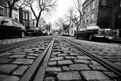
i wonder how long before they rip out these tracks and confine the streetcars to a museum in the burbs?
(long after i die, i guess.)
This is great. I love the Metro, but it takes forever to excavate new stations and costs a small fortune, the trolley system can be built fairly quickly and cheaply. Plus the trolley’s will have less overhead maintenance cost, so they are a far better investment. The map does not have estimated completion dates. Anyone know when the phases are planned to be completed? Only the H street line is being worked on right now.