
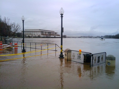
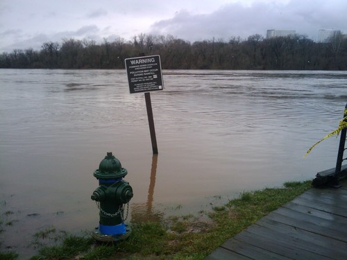
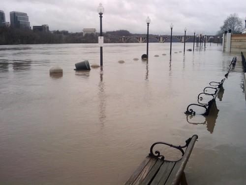
We’ve got a major Coastal Flood Warning today, with the tidal Potomac swelling to 3-4 ft above flood level, and 5-10 ft around Georgetown. Be safe and cautious if you live or work near the Potomac River or the C&O Canal, and don’t try to drive through flood water. The National Harbour boardwalk and parts of the driveway to K Street are inundated, and as has already been mentioned, a broken C&O Canal lock may cause additional flooding in Lower Georgetown. Parts of the The Mount Vernon Bike Trail are underwater, and of course Old Town Alexandria is getting swamped as well.
After the jump, a hydrograph and some bigger photos.
NWS Potomac River Hydrograph from measurements made at Wisconsin Ave show the tide peaking at just over 10 ft a bit after noon:

And here are more photos of the inundated National Harbour boardwalk and waterfront I took earlier this morning:

Pingback: uberVU - social comments
Pingback: Area Parks Are All Wet » We Love DC
Is the Georgetown Warterfront also called National Harbor? I thought National Harbor was in Maryland south of 495 where the Gaylord National is…
No, the GTown waterfront is called Washington Harbour. (Note the u.) I’ve heard people get them mixed up, though.